Urban Analyst
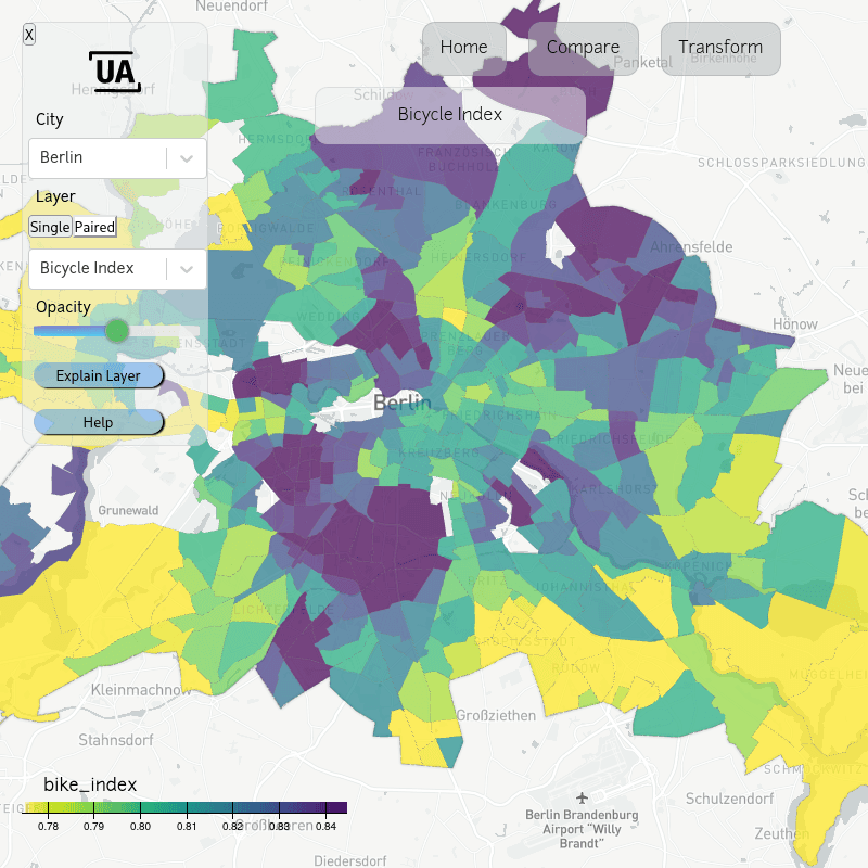
Urban Analyst (UA) is a platform for interactive visualisation and comparison of cities, including transport systems, measures of accessibility, and socio-demographic conditions. UA includes detailed interactive spatial maps of each city, charts comparing all cities, and analyses of how cities can be transformed to become more like other cities.
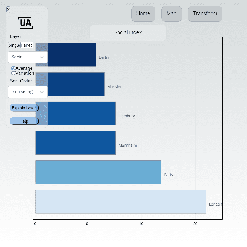
All measurements are also combined into a single “UA Index”, for which lower values are better than higher values. Think travel times or unemployment statistics. The best city has the lowest UA Index, with a score of 1 reflecting average scores in all individual components. Scores of all current UA cities, ranked from best at the top, are:
Unlike most other city scoring and ranking systems, the UA index is formed not just from a collection of individual measures, but also from the relationships between all pairs of measures. This includes relationships with social inequality, and thus the UA index is only low for cities in which aspects such as transport systems, provision of education, or access to nature, are developed in ways that counteract and reduce social inequality within a city. A good city works just as well, or better, for disadvantaged as for well-off residents.
To further understand differences between, and patterns within, cities, the site offers four ways to explore and compare cities:
Where do the data come from?
All data are obtained from openly published sources, as described in detail in the documentation pages. Results for each city involve billions of routing calculations through street networks and public transport systems. These are calculated using Urban Analyst's own open-source software also described in the documentation pages. These enormous numbers of calculations enable Urban Analyst to provide uniquely powerful insights into urban form and function.
Urban Analyst for your city
This main site is free and powered by open-source software. The data shown here are aggregated from highly detailed calculations at every street intersection in each city. Calculations include travel times from everywhere to everywhere using combinations of every conceivable mode of transport. The full-resolution detail of these data can be seen on the additional demonstration pages. City-specific Urban Analyst sites can be customized for any conceivable needs. To find out more, check out the demonstration pages, or email info@urbananalyst.city.
How can cities be added?
To request the addition of a particular city, email us at info@urbananalyst.city. Or open an issue on the GitHub repository of this site.